Flying Over Lake Hemet, CA [EN/PT-BR]
[EN]
Last week I went camping with my family at Lake Hemet, CA. I made a post earlier this week about the camping part, but had a busy week and only today I had a chance to edit and choose some drone photos to publish.
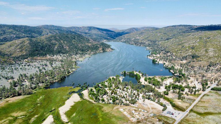
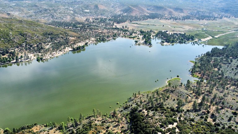
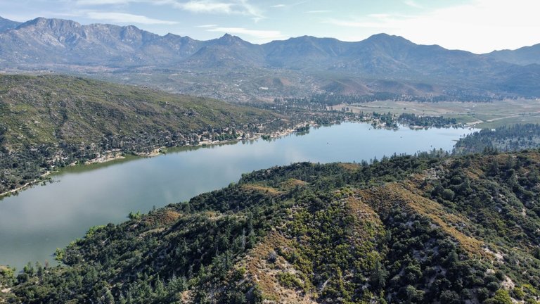
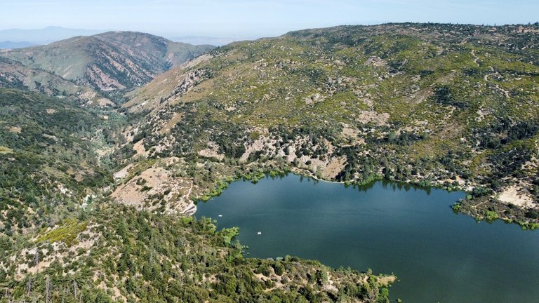
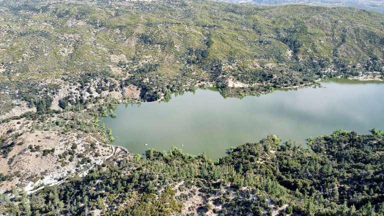
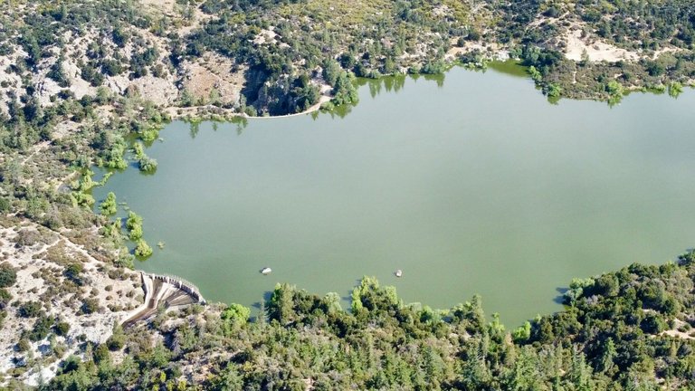
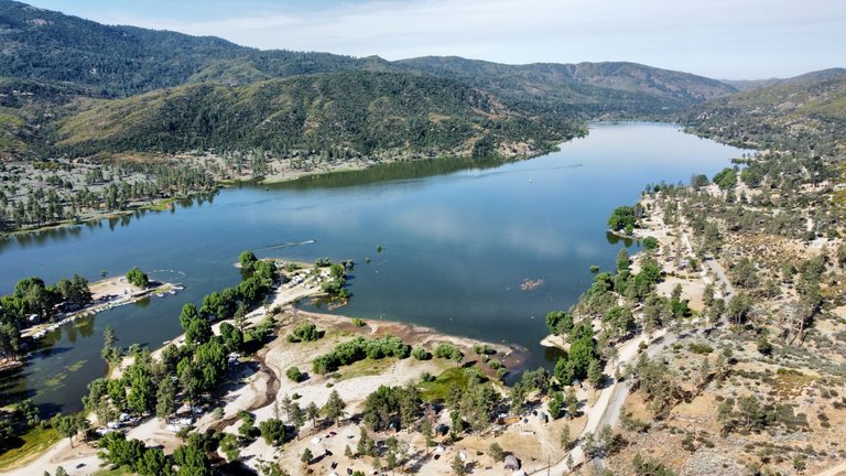
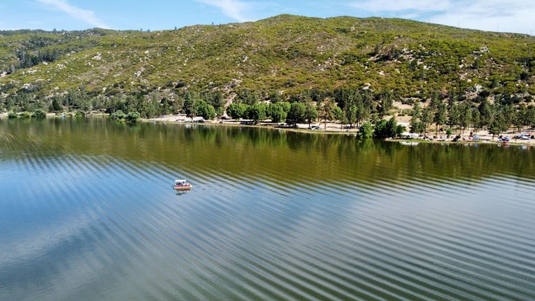
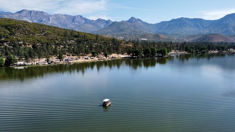
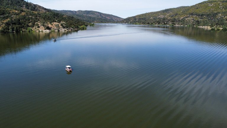
Lake Hemet is located in Riverside County and is a water reservoir created by the construction of the Lake Hemet Dam. The dam is located on the west side of the lake. Our campground was all the way east. The lake is about 1.5 miles (2.5 Km) long, and about 0.3 miles (0.5 Km) wide. I knew it was a long way for my DJI Mini 2 to reach, I had never flown that far before. But I wanted to get a shot of the dam.
We arrived on Friday afternoon, and when we got there it was pretty windy. The wind was blowing in shore from where I was (blowing east) and was not strong enough to keep me from flying, but I knew that I would drain my battery quick at on that condition. After sunset, the wind calmed down, so I knew that my best shot would be to fly early morning.
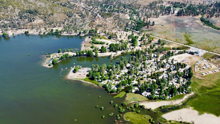
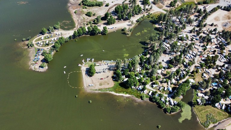
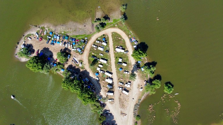
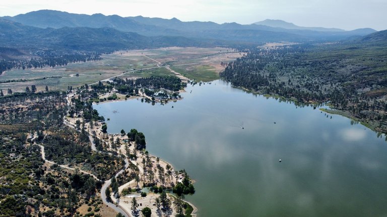
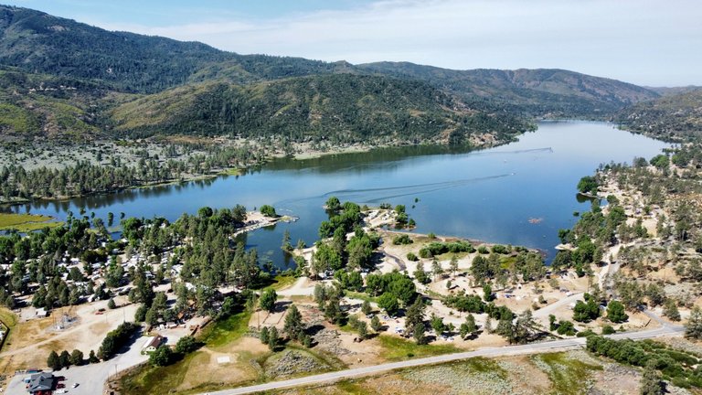
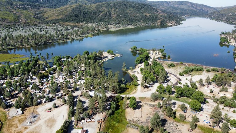
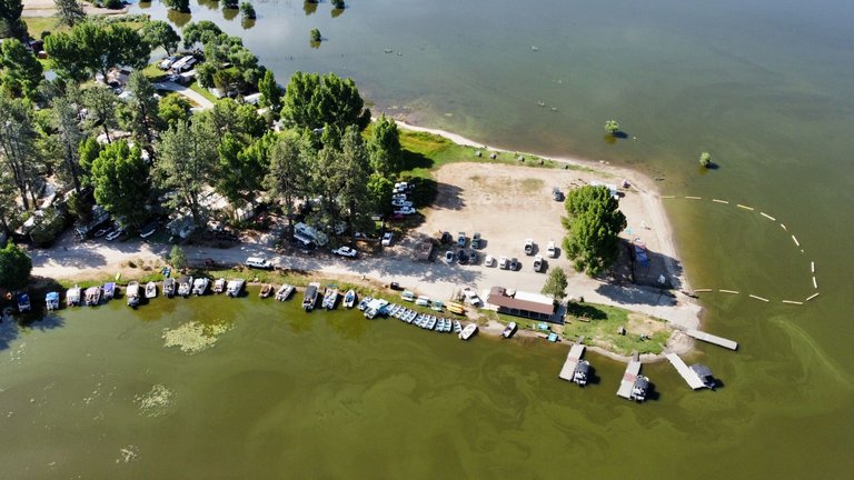
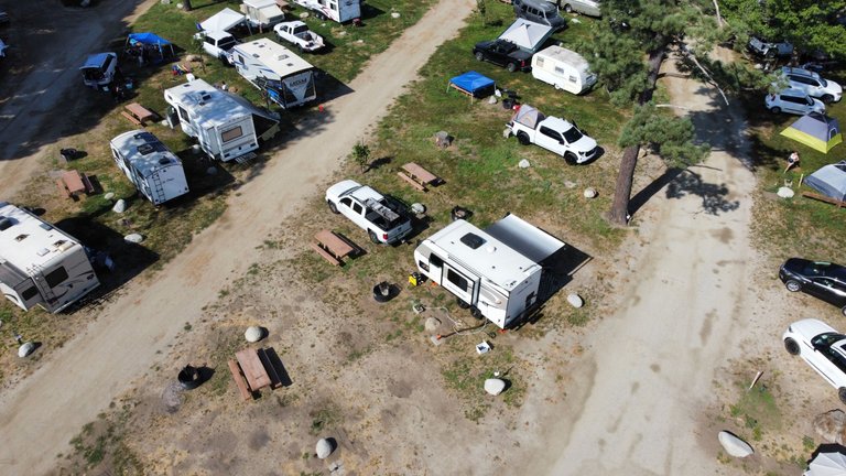
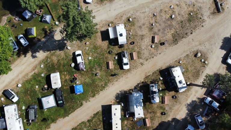
On Saturday morning I got it up to fly, and my son asked me to play with it. He almost never flys it, and this was a nice place to safely play with it. He flew around, took some pictures, and passed it back to me. I landed, switched batteries, and went up again. I flew all the way east of the lake to get a shot of the entire lake, and then back to get a few of the campground. When I came down the second time, the wind started to pick up, so I decided to stop for the day.
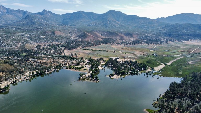
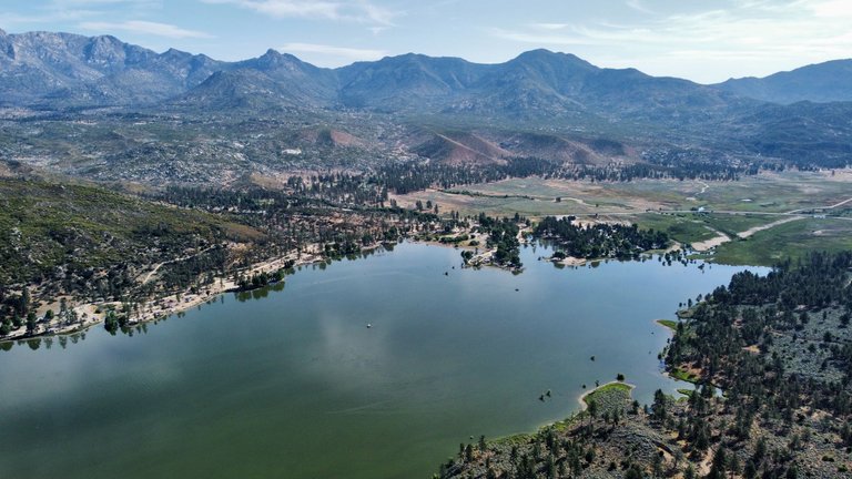
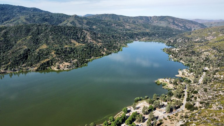
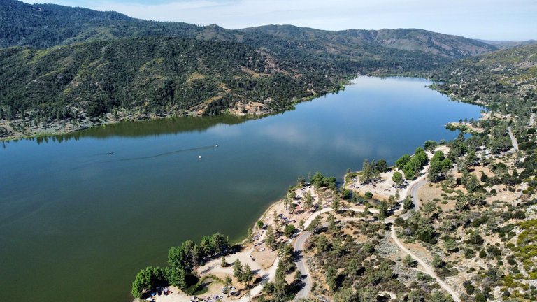
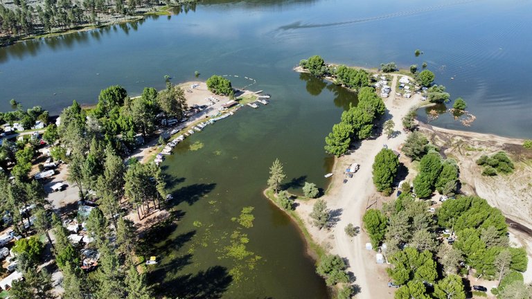
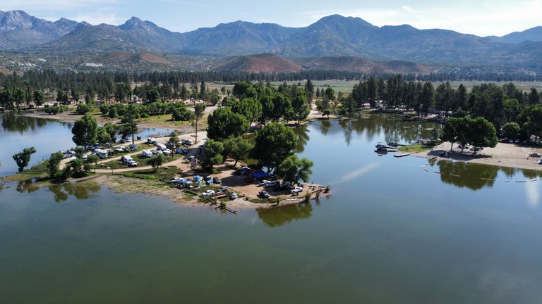
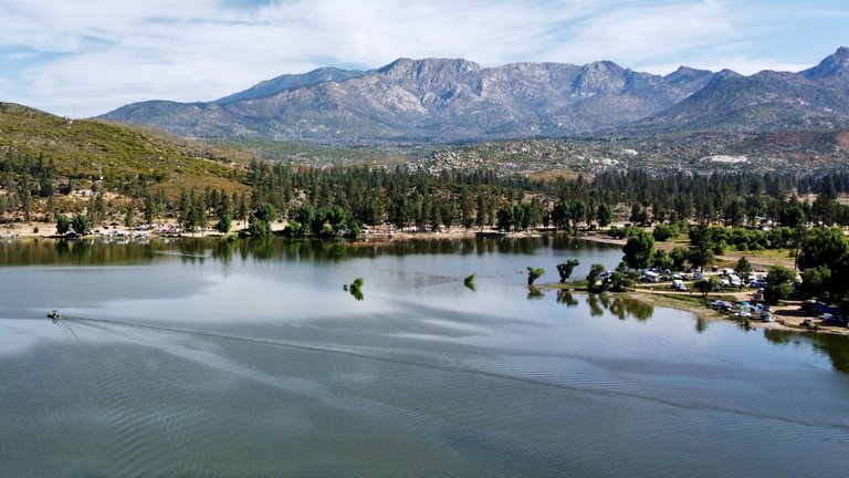
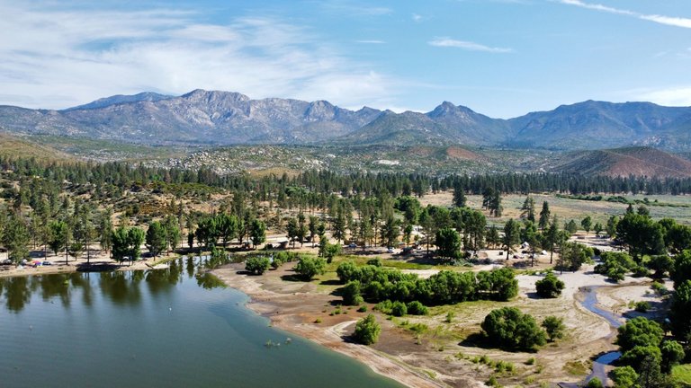
On Sunday early morning I went up again, and flew all the way west. I never went this far with my drone, I reached 2500m far and 350m high. I was able to get a shot of the dam, it was a little too far, but my drone was giving me battery warnings at 60% due to the distance. I tried to lower my altitude for a closer shot, but my signal got too weak. So I decided to start flying back above the north shore of the lake. I got a few more pictures near the campground from different angles, and that was it.
Let's check it out!
[PT-BR]
Na semana passada, fui acampar com minha família no Lago Hemet, CA. Fiz um post no início desta semana sobre a parte do acampamento, mas tive uma semana complicada e só hoje tive tempo de editar e escolher algumas fotos de drone para publicar.
O Lake Hemet está localizado no condado de Riverside e é um reservatório de água criado pela construção da represa do Lake Hemet. A represa está localizada no lado oeste do lago. Nosso acampamento ficava no lado leste. O lago tem cerca de 2,5 km de comprimento e 0,5 km de largura. Eu sabia que era um longa distância para o meu DJI Mini 2 alcançar, pois nunca tinha voado tão longe antes. Mas eu queria tirar uma foto dessa represa.
Chegamos na sexta-feira à tarde e, quando chegamos, estava ventando bastante. O vento estava soprando de frente pra onde estávamos (de oeste pra leste) e não era forte o suficiente para me impedir de voar, mas eu sabia que gastaria minha bateria rapidamente nessas condições. Depois do pôr do sol, o vento se acalmou, então eu sabia que minha melhor chance seria voar de manhã cedo.
No sábado de manhã, eu me preparei para voar e meu filho me pediu para brincar com o drone. Ele quase nunca voa com o drone, e esse era um bom lugar para ele brincar com segurança. Ele voou, tirou algumas fotos e me devolveu. Eu pousei, troquei a bateria e subi novamente. Voei até o leste do lago para tirar uma foto do lago inteiro e depois voltei para tirar algumas fotos do acampamento. Quando desci pela segunda vez, o vento começou a aumentar, então decidi parar.
No domingo de manhã cedo, subi novamente e voei até o lado oeste do lago. Nunca tinha ido tão longe com meu drone, cheguei a 2500 m de distância e 350 m de altura. Consegui tirar uma foto da represa, estava um pouco longe demais, e meu drone ja estava me dando avisos de pouca bateria a 60% devido à distância. Tentei diminuir a altitude para conseguir uma foto mais próxima, mas meu sinal ficou muito fraco. Então, decidi começar a voar de volta pela margem norte do lago. Tirei mais algumas fotos perto do acampamento de diferentes ângulos, e foi isso.
Dá uma olhada!
Day 1 - Dia 1
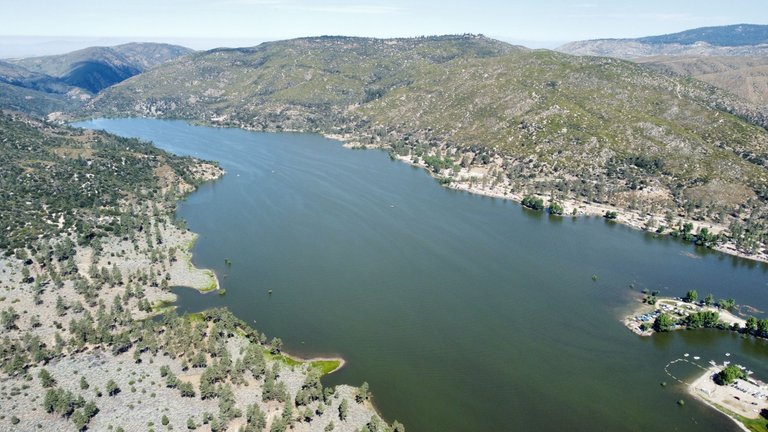
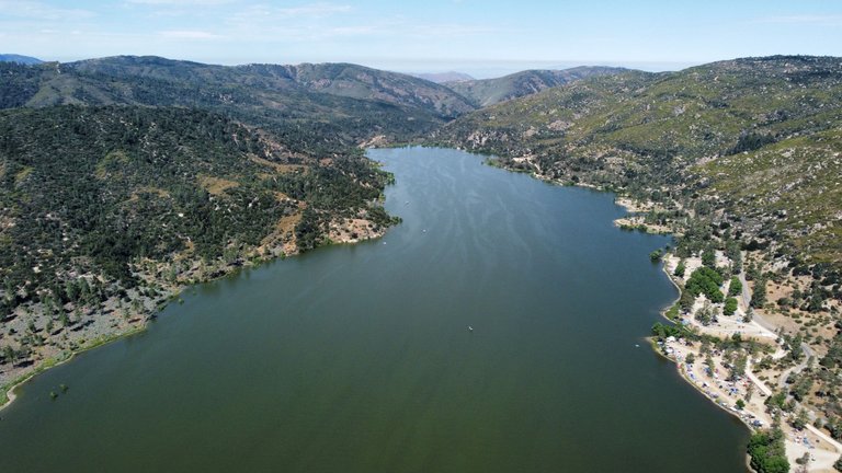
Day 2 - Dia 2
Hope you enjoyed it! See you next time!
Espero que tenham gostado! Até a próxima!
Obrigado por promover a comunidade Hive-BR em suas postagens.
Vamos seguir fortalecendo a Hive
Congratulations, your post has been added to Pinmapple! 🎉🥳🍍
Did you know you have your own profile map?
And every post has their own map too!
Want to have your post on the map too?
Your post was manually curated by @Shiftrox.
Delegate your HP to the hive-br.voter account and earn Hive daily!
🔹 Follow our Curation Trail and don't miss voting! 🔹
manero demais, bicho!
Imagina em Arraial?
Ia ser foda! Vou ter que comprar um pra próxima viajem haha
Imagens maravilhosas mengão!! Deu até vontade de comprar um drone tbm! kkk
Valeu!! É um brinquedo bem divertido. Vale o investimento.
Que beleza de lugar mano, brincar com um drone e fazer essas imagens é tudo de bom!
!PGM !PIZZA !LOL
BUY AND STAKE THE PGM TO SEND A LOT OF TOKENS!
The tokens that the command sends are: 0.1 PGM-0.1 LVL-0.1 THGAMING-0.05 DEC-15 SBT-1 STARBITS-[0.00000001 BTC (SWAP.BTC) only if you have 2500 PGM in stake or more ]
5000 PGM IN STAKE = 2x rewards!
Discord
Support the curation account @ pgm-curator with a delegation 10 HP - 50 HP - 100 HP - 500 HP - 1000 HP
Get potential votes from @ pgm-curator by paying in PGM, here is a guide
I'm a bot, if you want a hand ask @ zottone444
lolztoken.com
Those who understand Roman numerals and those who don't
Credit: reddit
@mengao, I sent you an $LOLZ on behalf of shiftrox
(5/8)
ENTER @WIN.HIVE'S DAILY DRAW AND WIN HIVE!
$PIZZA slices delivered:
@shiftrox(4/15) tipped @mengao
Beautiful shots! Thanks for sharing!
Thank you!
Some beautiful pictures for sure!
Really lovely pictures 😍