Bush Bay Trail AKA: The Narnia Trail
I've talked about it in the past, but this just happened to be one of those times I stumbled across something on Facebook and decided I needed to tuck it away to check out at a future date. When people cross over the Mackinac Bridge from the lower peninsula of Michigan to the upper peninsula of Michigan, they usually go one of two ways. Either they continue North to the town of Sault Ste. Marie on the border of Canada, or they immediately get on US 2 to head West into the vast open expanse of the upper peninsula.
However, there are a few individuals who choose to head East. While there is a lot of land to the East of the bridge, there just isn't that much in the way of population. Which makes it a perfect place to explore. When I saw the story for the "Narnia Trail" on my Facebook feed, I decided it might be worth checking out.
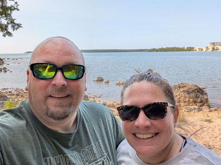
Oddly enough, shortly before we were slated to leave for this trip, @mrsbozz also saw something about the trail and said "hey we should check this out". I laughed and let her know it was already on my agenda. Thus, on a cool Friday morning in July we left the Straits State Park campground and made the 40 minute or so drive to Bush Bay where one end of the trail starts.
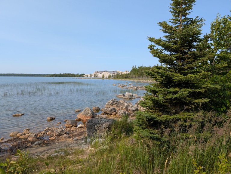
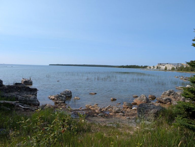
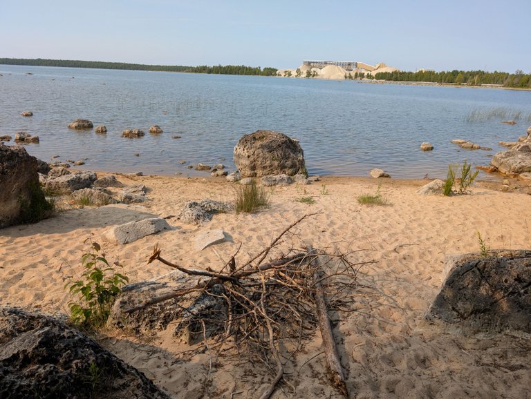
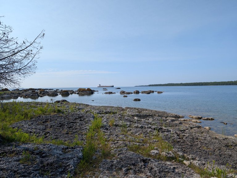
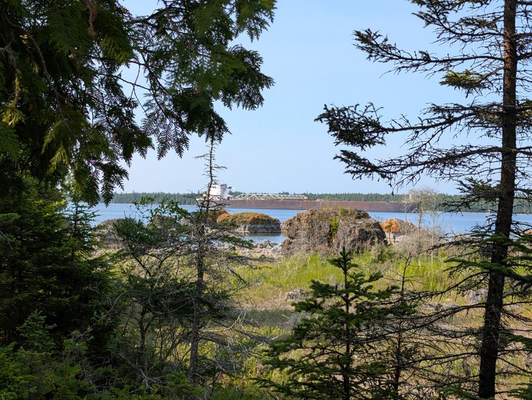
Bush Bay sits right next to a large limestone mining operation, and if you look really closely in the second photo above you can just make out a freighter heading towards the quarry to get loaded up with limestone or dolomite or whatever. If you can't see it, don't worry, I have better photos coming in a bit!
I wasn't really sure what to expect from the hike, but in all, it wasn't too bad. I think we ended up hiking something like 7200 steps and 3.31 miles which over this terrain was pretty impressive. According to my wife's Fitbit, the hike gave her 83 active minutes. I think the whole trail is something like four miles long, but we turned back after we got to the "Narnia" part of the trail. Oddly enough, it turns out there was another access point at the other end of the trail and if we had parked there instead of where we did, we could have cut about three miles off our hike.
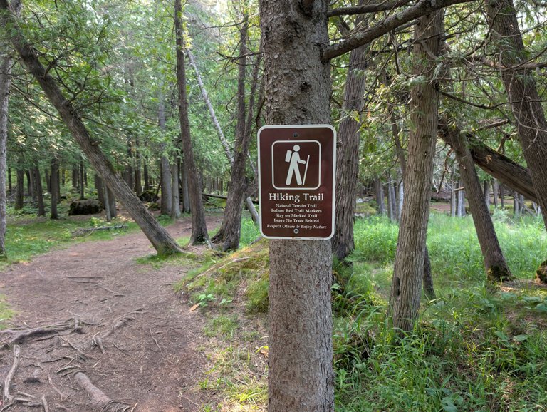
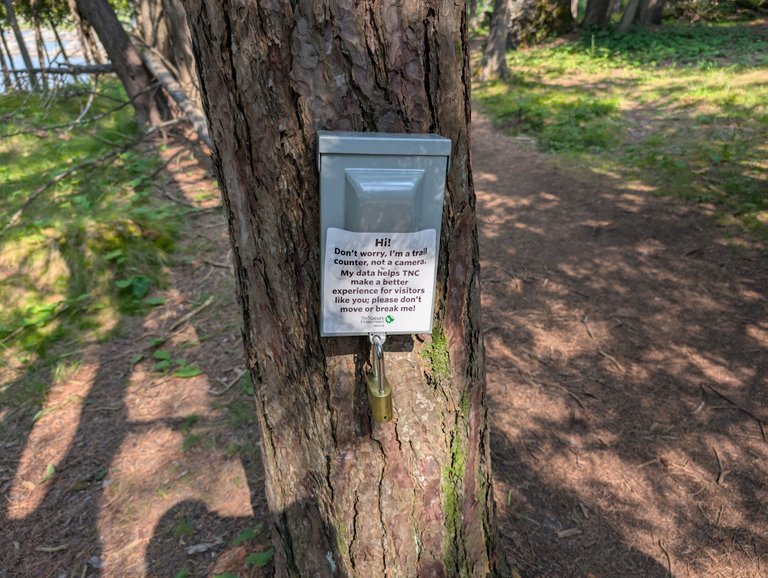
We weren't complaining, it was a great hike and the scenery was quite beautiful. It was a fun adventure for both of us. As you can see from the photos above, they have the trail quite well marked both coming and going, and they have a trail counter to keep track of how many people access the trail.
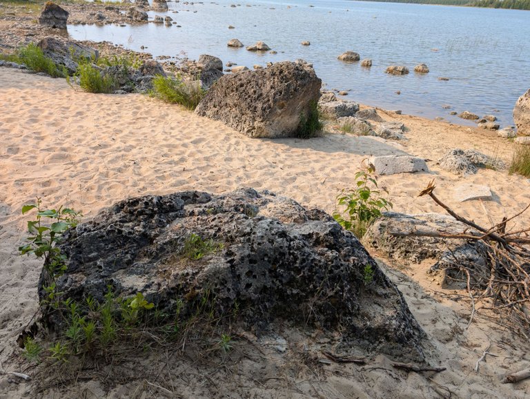
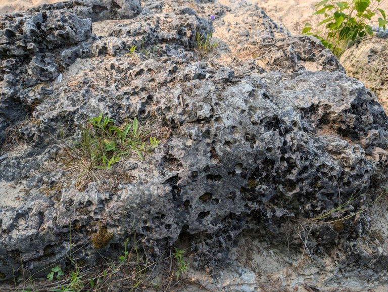
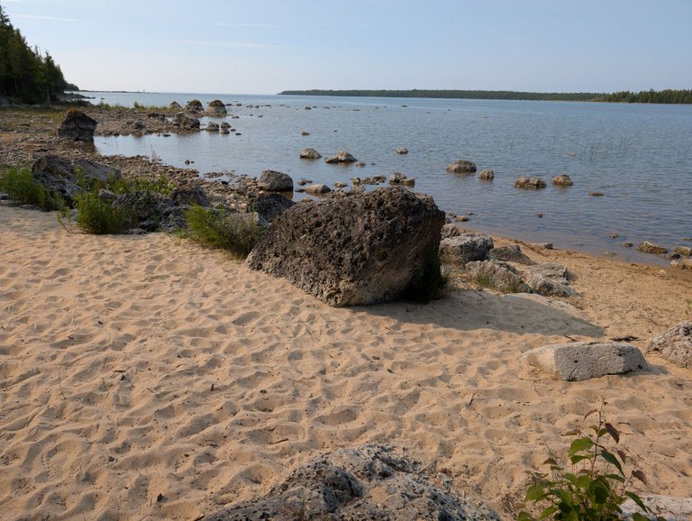
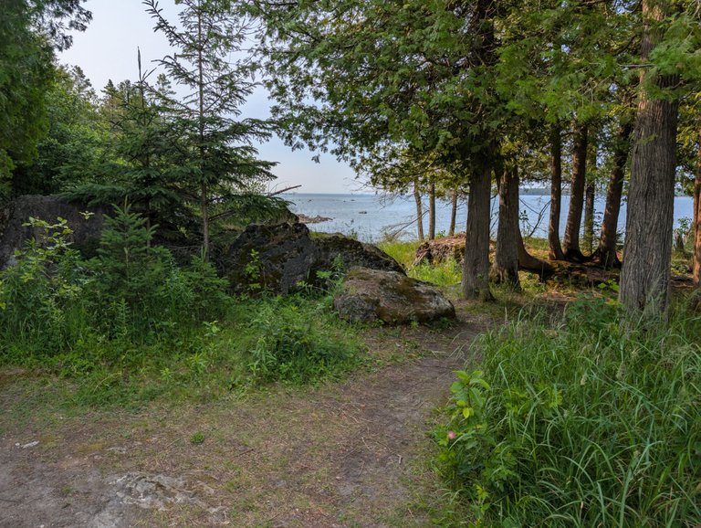
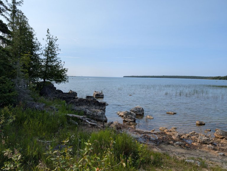
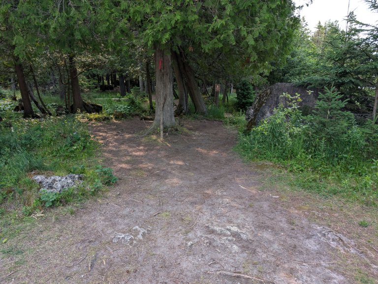
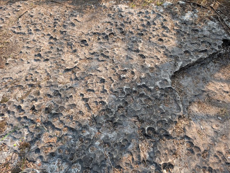
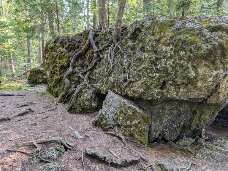
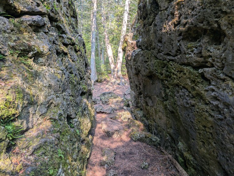
The first part of the trail takes you right along the coast of the bay before it eventually turns inland and the open water turns into dense forests. The trail was littered with large rocks like the ones you see above that had all these little pock marks in them. Check out the photos below for more on that.
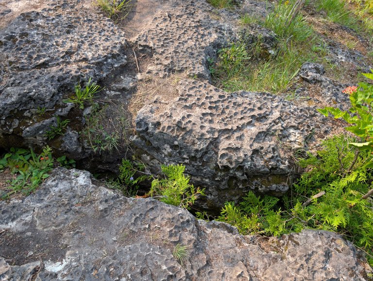
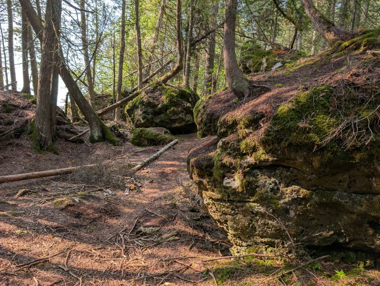
Eventually, we got to a point where the rocks were pretty massive and we had to do a bit of acrobatics to get through them and stay on the trail. I wouldn't say it was strenuous, but as we were coming back on the trail we passed a few elderly people and we questioned whether or not they would be able to navigate the trail without breaking a hip or something.
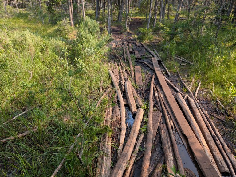
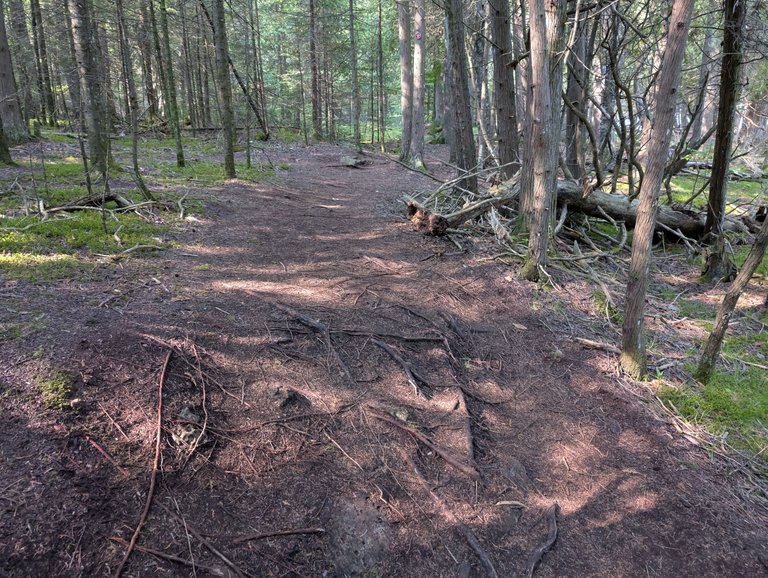
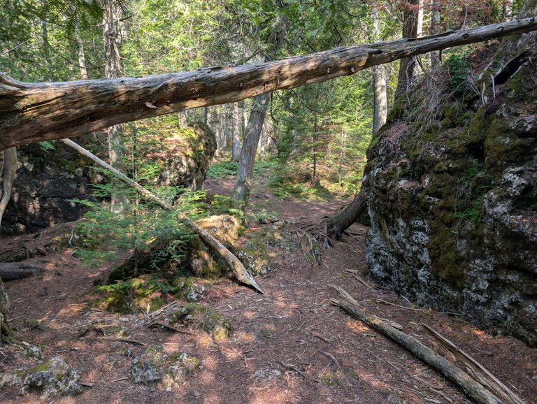
Some areas of the trail were a bit muddy, but luckily people had put down logs and other pieces of wood to make the navigation more manageable. In the areas where there weren't rocks, we were often left to deal with tangles of roots. I'm actually shocked my wife didn't come away from this hike with a twisted ankle or something similar. She has some old basketball injuries that tend to flare up after putting stress like this on them.
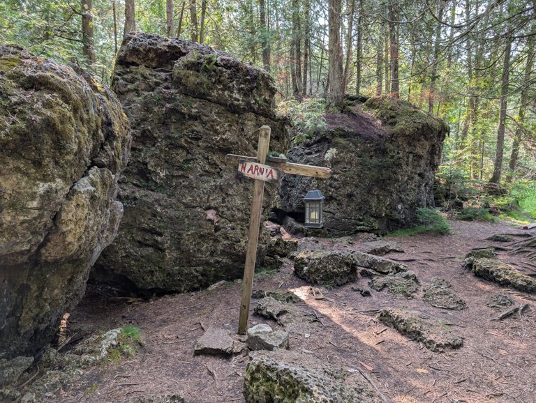
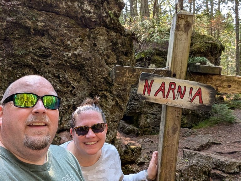
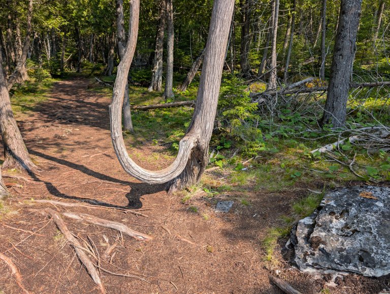
As I said, after a bit, the trail turns in towards the land and that's where we eventually found the "Narnia" portion of the trail. I'm guessing at some point, someone thought it felt like the primordial forest that the kids were dumped into after going through the wardrobe. They decided to throw up a lamp post and sign and thus the name was earned.
Besides the sign and the large boulders, there isn't much to see at this point. In fact, I think @mrsbozz looked at me and said something like "this is it?". That isn't to imply we were disappointed. In fact, we really enjoyed the hike and it gave us a lot of memories, but if you come here as a Narnia fan hoping to see something spectacular, you are likely going to be disappointed.
Better yet, if you come hoping to find a gateway to the magical land, you are going to be even more disappointed!
I will say that it was kind of cool back in this area because the compacted roots and plant material on the trail made it sound like you were walking on a hardwood floor as you traversed some of the rocky tree covered areas. It was pretty surreal.

After hanging around the "lamppost" for a bit, we decided to turn back. If I had known how close we were to the other access point, I might have had us do the full circuit, but the fact is, the farther we walked away from our truck, the further we had to walk back to it. I'm not really sure the other half mile of the trail would have shown us much more than we had already seen.
If you enjoy nature, hiking, and beautiful views, I highly recommend this trail. It was pretty awesome and I wouldn't hesitate to go back and visit it again. I think if we hadn't been so focused on the "Narnia" part of the trail, we likely would have spent more time in the first mile or so just enjoying the views. That isn't to say the moss covered boulders and trees weren't cool, but if that is all you are focused on, you are really missing out.
We got lucky and the bugs weren't too bad on our hike, but I was constantly keeping a wary eye out for black bears which are pretty common in the upper peninsula of Michigan.
My Sports Account - @bozz.sports

Hola, me gustan sus fotografias, se ven muy bien, detalladas, con calidad, se ven increibles, tu puedes seguir logrando tomar mas fotos y publicarlas, nunca te rindas, tu puedes lograr muchas cosas, ten confianza en ti, y si algo sale mal, lo corriges, nunca te rindas.
Thank you!
De nada.
That rocky section is a real adventure! It’s those kinds of spots that remind you to take it slow and steady and maybe appreciate the trail even more for its wild, natural feel. Nice place!
Yes, it was pretty interesting for a bit there. We had to focus very intentionally on where we were stepping.
Oh! Those parts definitely keep you on your toes. It makes the hike a bit more exciting, huh!😀
While the payoff might have been a bit disappointing I am amazed at how clean it is on those trails!
In the more remote areas like this people tend to care a bit more I think. We didn't really see any trash along the way and the path was well marked. There were only a couple of spots we weren't sure which direction to go.
With a name like that, how can you not explore? Too bad it wasn't book related to the books, but some of those rocks do look pretty cool. Great photos!
Yeah, I had seen the lamppost in other photos that people had shared, but I thought there was going to be more to it. It was still a great hike without the "Narnia" part, but the lead up was a bit of a let down.
Excellent photographic shots
Thank you!
The atmosphere here is so good. The serenity and the peace of such places just attract visitors. Hope you have enjoyed well over here! I just loved these captures!
Have a good day!
Thank you! It was a pretty special place. We had it mostly to ourselves until we were on our way back, then we came across a couple groups of people.
Hiya, @lizanomadsoul here, just swinging by to let you know that this post made it into our Honorable Mentions in Travel Digest #2628.
Your post has been manually curated by the @worldmappin team. If you like what we're doing, please drop by to check out all the rest of today's great posts and consider supporting other authors like yourself and us so we can keep the project going!
Become part of our travel community:
It's certainly an interesting area and seeing the evidence of that area previously being under an ocean is interesting as we see similar evidence in Southern Indiana and down through Kentucky. That part of the country is part of my bugout plans if we get nuked. I could make my way up Lake Michigan by boat if need be. Get to that area and go into Lake Huron or traverse up to Lake Superior and go way up North or Way West on it while the major cities deal with nuclear fallout.
I've never been to that part of Indiana, but I have been to Hocking Hills in Ohio and the Mammoth Cave Area of Kentucky as well as outside of Lexington, so I know what you are talking about. I have a feeling a lot of people would be thinking the same thing. My buddy has some property in the UP, but I think getting my trailer up there would be impossible.
Certainly could be different levels of damage. If the roads are all blocked I would go to my parent's house first because there is a flowing fresh water well there. If that's not a good spot we might have to make it to lake Michigan on ATVs and then highjack a boat to go up North on the Lake.
View more
That the beauty of true relationship. You both compliment each other and knows what is there on other heart. Like the way Mrs.bozz and you both have plan for Narnia...such hike is alwsys adventurous. Safety is always big concern, but having such a scenic beauty around, everyone wants to enjoy the moments by staying safe....you both had a lovely time..👍👍🤗
Thanks! It was a bit out of our wheelhouse, but we had a lot of fun. I could see us doing more like this in the future!
Now that's a hike I can imagine taking! ;)
It's such a beautiful place to unwind and relax ,specially with someone you love the most !
Absolutely! It was amazing!
what a beautiful place for hiking and the refreshing beach is a perfect place to relax.
It really was!
Its a nice spot to have a hike on.You guys found the perfect place to hike,Im sure you guys enjoyed the beauty of nature.
Yes, thank you! It was so amazing!
Beautiful Lake Huron.. my family is from Drummond Island …Going back to 1812 …
Voyageurs ….
We were Voted off the Island … just like here on Hive LoL !
Chippewa (Ojibwe) roots on Mackinac
That's cool. It is a beautiful area! Probably even more so back in the day!
I, too, love going on hikes! If you check out my introduction, you would see how much of a necessity it is for me as an athlete. Also, if you love animals, you will surely love my most recent post! Please do check it out whenever you can! 🐶❤️🇵🇭
We lost our dog in the Spring of last year, so I am kind of done with animals for a good decade or three. Hikes are pretty cool and while my wife and I walk a lot, we don't often take hikes like this.
Looks like a beautiful walk man! Is that an abandoned cargo ship at the end? lol
I love the pock marked rocks! I wonder if that's from the Younger Dryas Impact hypothesis, where some of the northern half of the country got whacked by a few meteors over the years, thus ending the ice age. Certainly looks like it with those rocks!
I think it was worth it to get to the lamp post!
I am not sure about the rocks. That is an interesting theory though. No, the freighter was heading to the limestone dock to get filled up I think. It eventually moved into the other bay and we lost track of it.
Still, the hike and the views look amazing, and it’s giving me the urge to go on a nature trip myself. I love that mix of forest and rocky paths.
Very cool hiking trail, nature looks similar but a bit different than in Washington state, I guess I don't see all the moss that we have on the trees and something else that I can't really put my finger on.
Oh and I guess that is the same US 2 that we have here as well :)
It's interesting because there is also a US 2 down in northern Ohio, but I am not sure the two are connected. Perhaps they are. Maybe the one down there is Ohio 2, I honestly don't know. We don't have quite the elevation you folks probably have over there.
That was a perfect trail, nice to enjoy walking and making exercise. A beautiful landscape and fresh air is waiving here.
It was a bit more strenuous than we were expecting, but the views and the sounds of nature made it more than worth it. We had such a nice time!
De verdad son vastos territorios
That is a cool trail, and a great hike. I bet you were both pretty worn out after that one, but there are some great rock formations and interesting trees. I wouldn't mind doing a hike like that, you just have to be careful on those on logs it looks like!
Great pictures!
Yeah, like I said, I thought sure my wife was going to twist her ankle. We were so beat and it started to heat up by the time we got back to the truck. We just sat there a bit with the AC on chugging water before we headed back.
The name alone—Narnia Trail—already feels magical. I haven’t been yet, but it looks like the kind of place where nature tells its own fairytale. Can’t wait to see it one day! 🌲✨
I hope you get the chance to, it was pretty amazing.
https://bsky.app/profile/did:plc:u37t33dyaufvrqujwmvm54ln/post/3luhtk5hnmk2w
https://bsky.app/profile/did:plc:u37t33dyaufvrqujwmvm54ln/post/3luhtk5hnmk2w
The rewards earned on this comment will go to the author of the blog post.
You can check out this post and your own profile on the map. Be part of the Worldmappin Community and join our Discord Channel to get in touch with other travelers, ask questions or just be updated on our latest features.
You received an upvote of 100% from Precious the Silver Mermaid!
Please remember to contribute great content to the #SilverGoldStackers tag to create another Precious Gem.
I assume those are limestone boulders, made from prehistoric organisms?
Yes? Yeah, I think that is probably the case. The glaciers had a big impact on this part of the US.
Congratulations @bozz! You have completed the following achievement on the Hive blockchain And have been rewarded with New badge(s)
Your next target is to reach 64000 comments.
You can view your badges on your board and compare yourself to others in the Ranking
If you no longer want to receive notifications, reply to this comment with the word
STOP