Day Hike @ Tongariro Alpine Crossing
Hi to everyone who's reading!
This is my first post in this community and I would like to share about the most memorable hike in my life. That would be the Tongariro Alpine Crossing because it is one of the top single day hikes in New Zealand or perhaps even in the world.
If you find this familiar, I actually mentioned this briefly in April in my first ever post (here) in the Weekend Engagement series, under the prompt "Favourite Moment With Nature". So coincidentally, this hike also made its way to my debut entry in this community! Hehe!
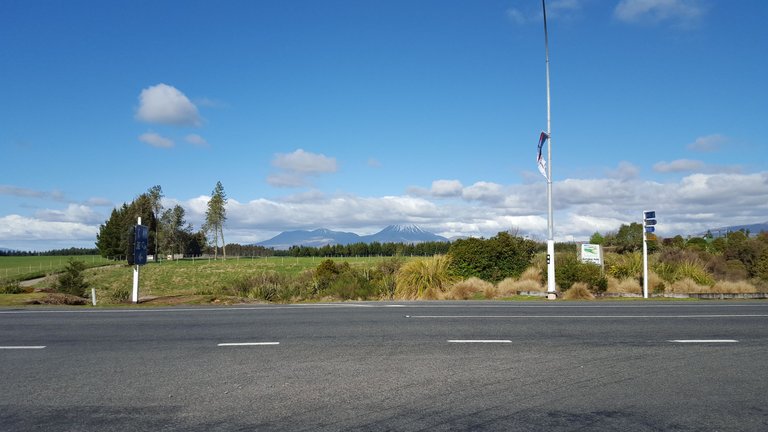
To begin, my friend and I took a bus from Auckland to one of the many lodges in the area for an overnight stay. The roads were quiet and there were so many mountains everywhere we looked.
Time: 08:00
We woke up extremely early in the morning to have our breakfast and packed our supplies. Transport were catered by the lodge to send us to the starting point. I remembered the temperature was single digits and winds were chilly so I wore multiple layers including a windbreaker and gloves. Here we go - 19.4km!
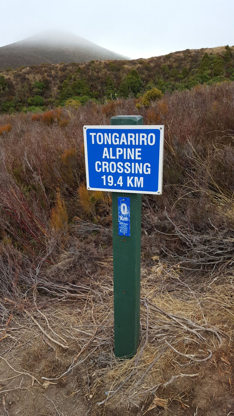
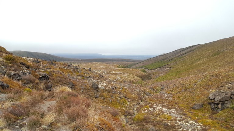
We started hiking at 0800h from Mangatepopo Valley and the target was to reach the end point around 1600h. The starting terrain was easy but I wasn't the fittest to begin with, and I lagged behind the main group of hikers as I wanted to pace myself for the full day hike.
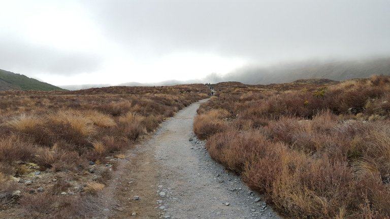
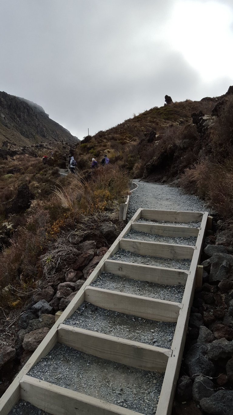
Stairs were a constant feature as we ascended the terrain and I must say that the paths were well marked and well maintained as well. (It's quite difficult to lose your way.)
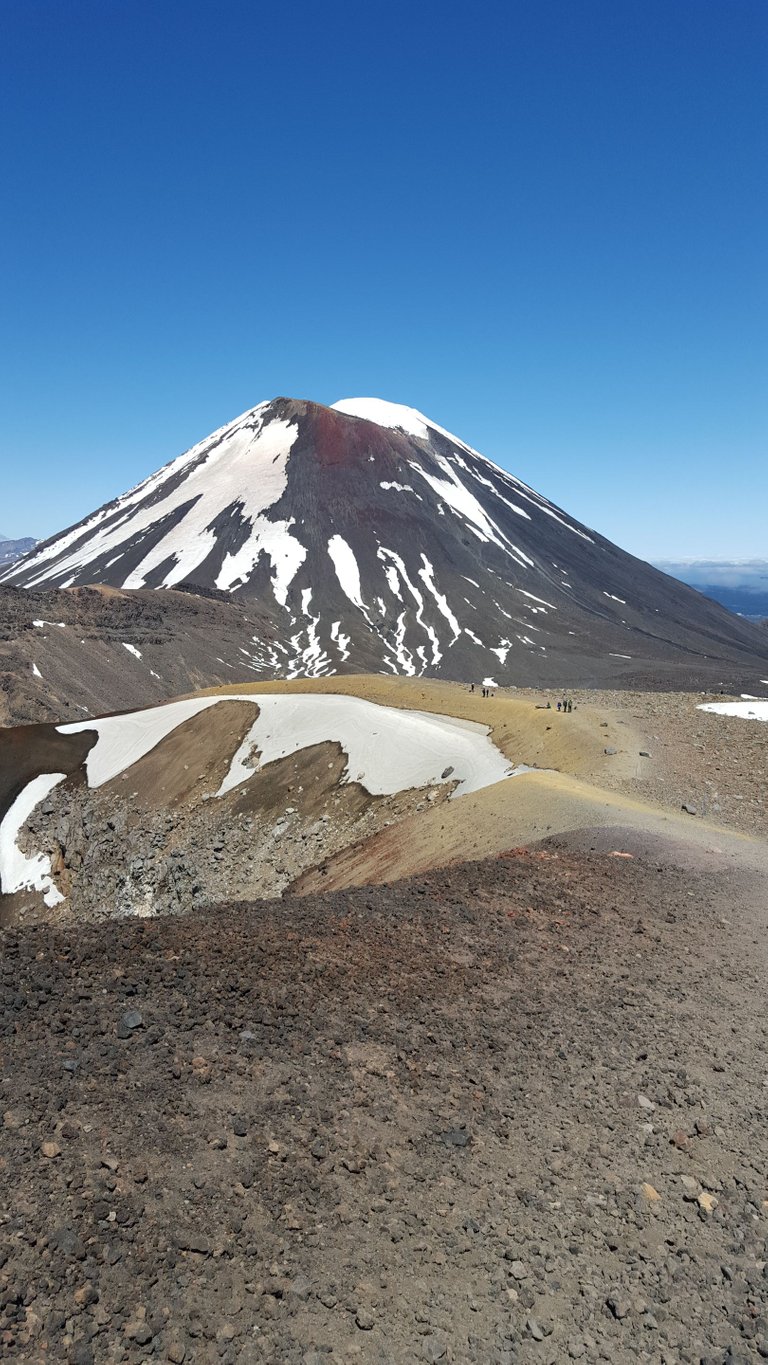
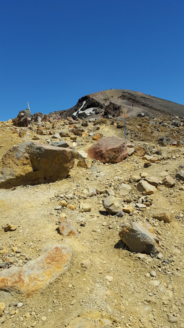
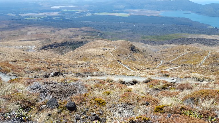
The sun had risen by the time we made it up the winding path. Look how small the people were in this photo.
Time: 09:00
More winding paths ahead. Each time I felt tired and wanted to take a break, I would just admire the scenery and snap some photos. (But we soon realised we were going too slow and running behind schedule. Oops!)
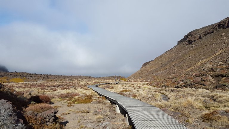
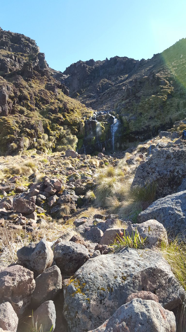
We finally reached Soda Springs, which was a waterfall. As we were behind schedule, we didn't venture closer and continued with our hike.
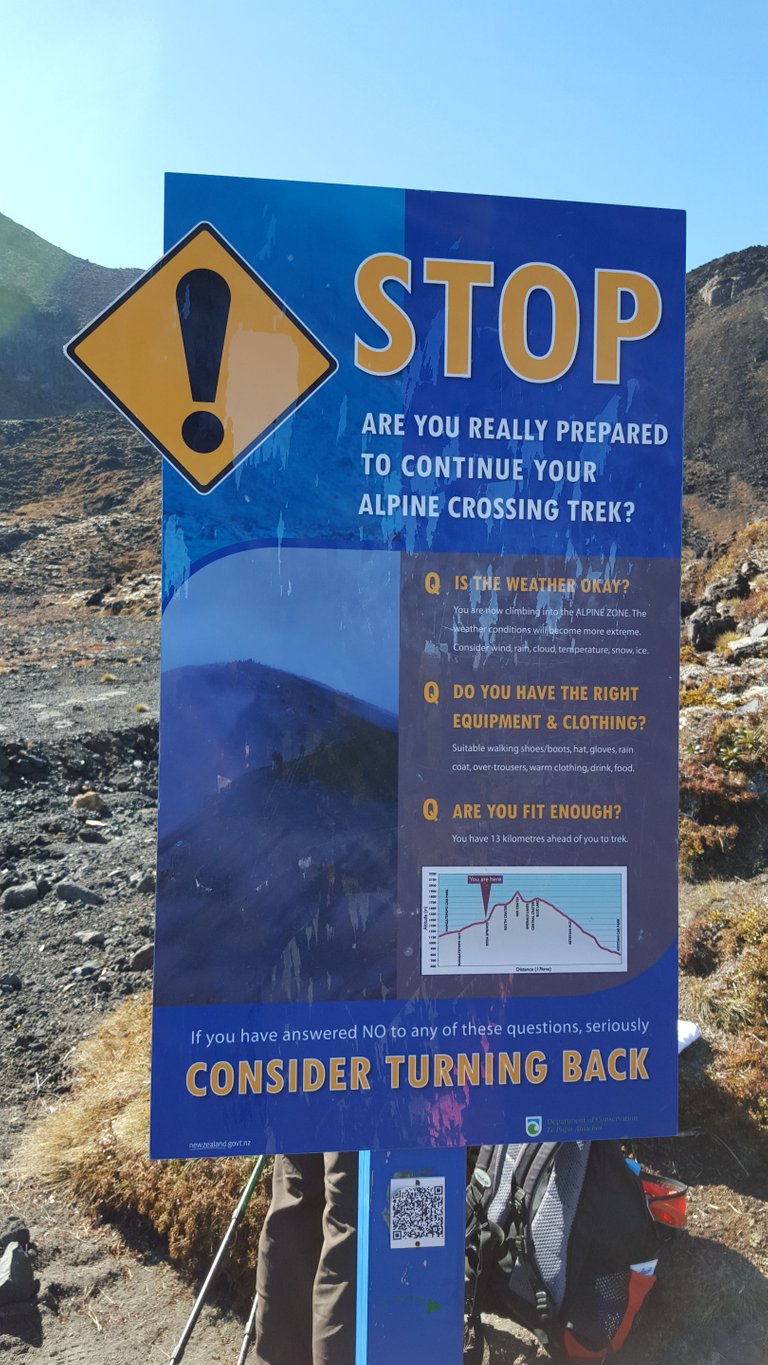
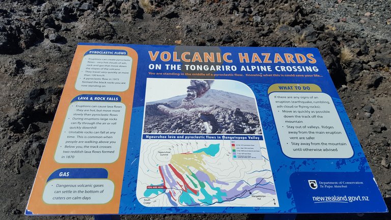
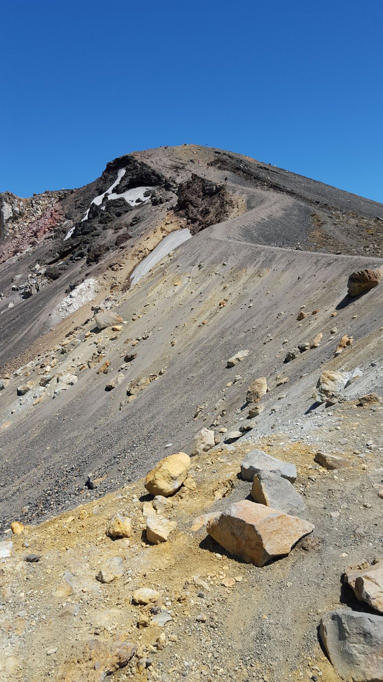
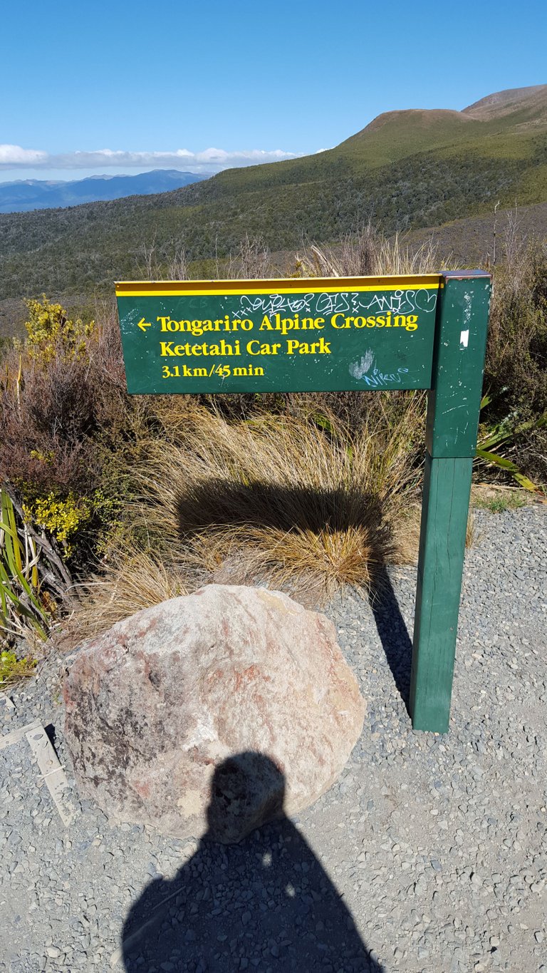
We were then greeted with a WARNING, because the terrain was going to be quite steep going forward, and after this point, it didn't make sense to turn back because it would be easier to complete the path instead. The sign said 13km to go so we were 6km down!
Time: 10:00
And here we go! Up up up we go!
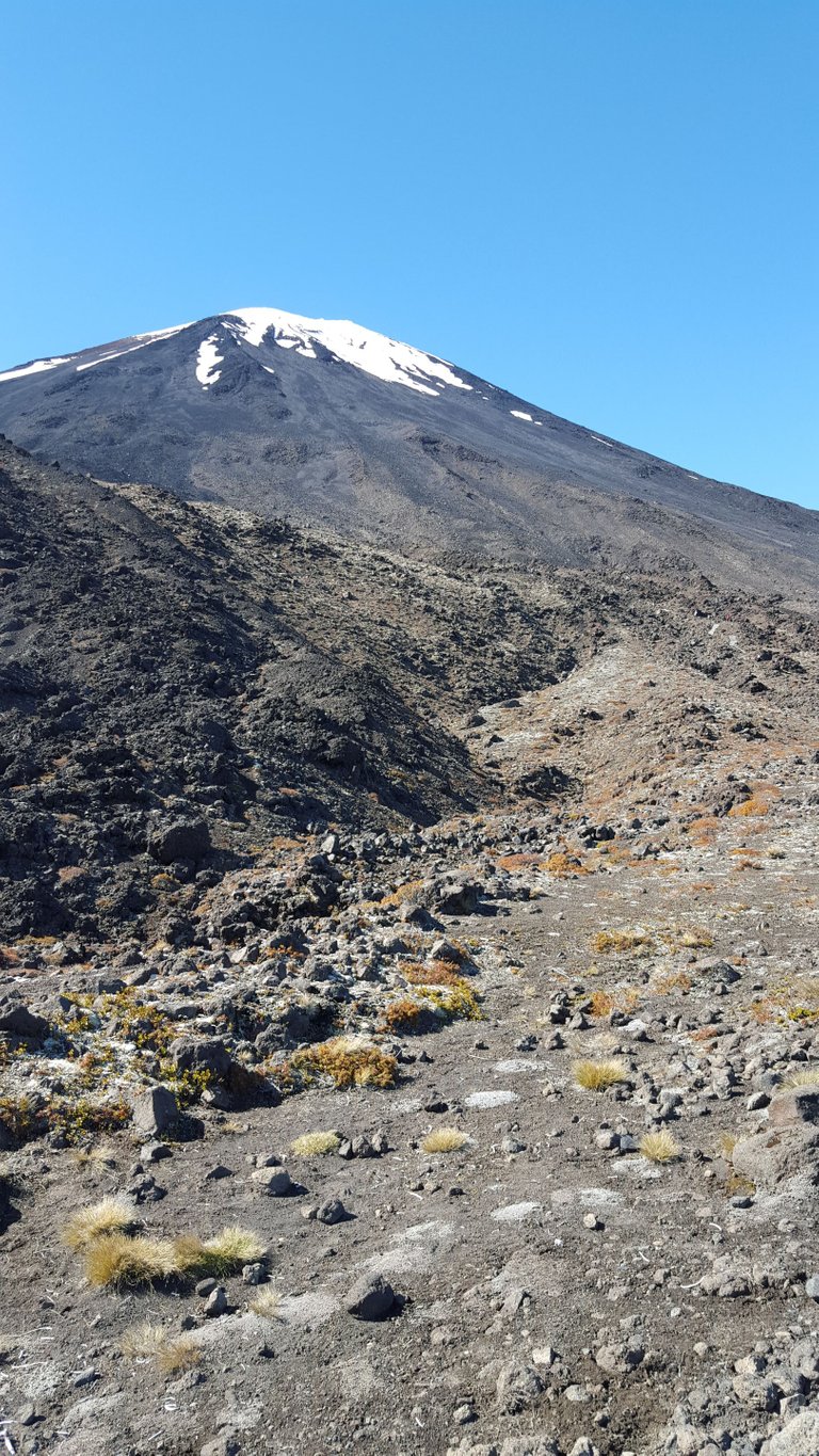
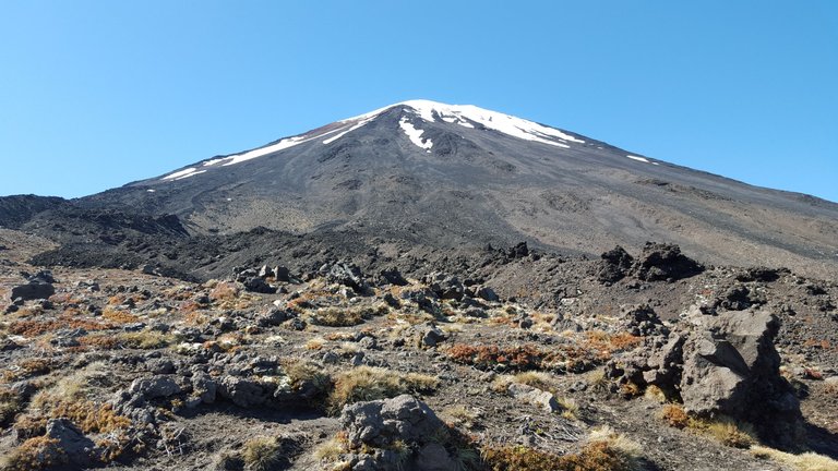
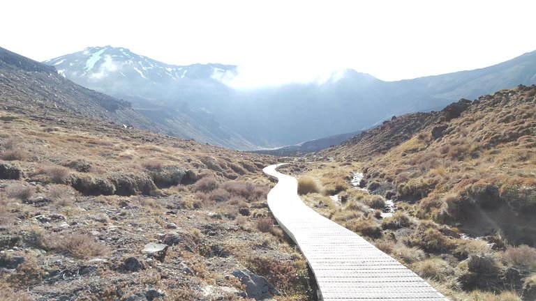
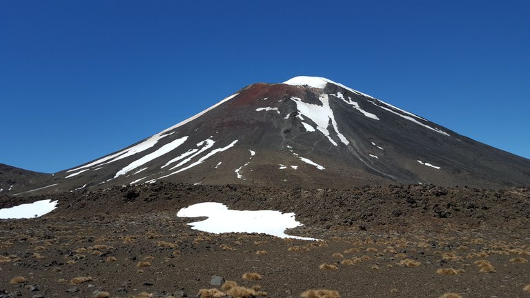
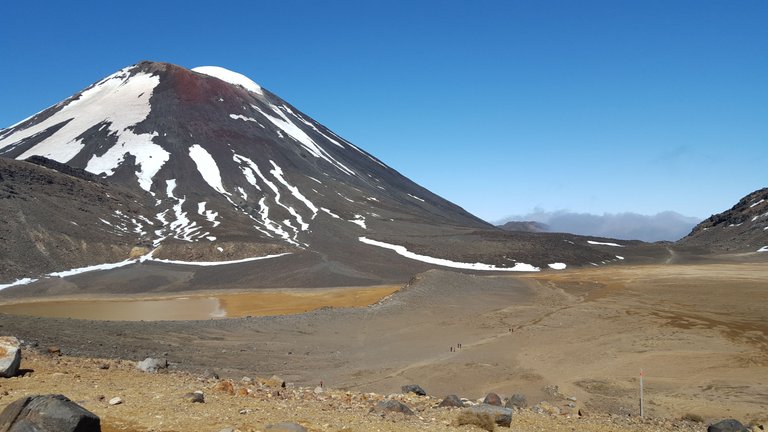
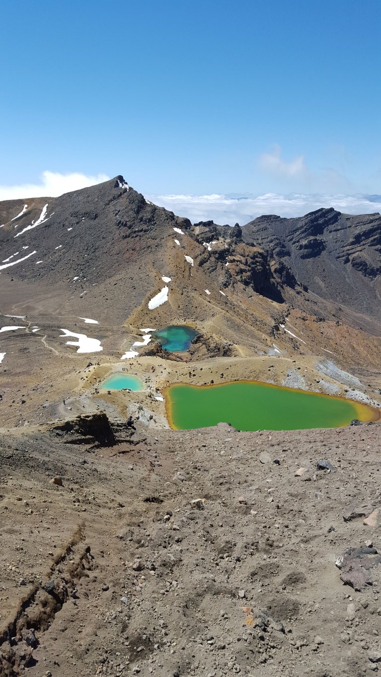
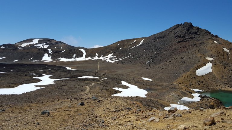
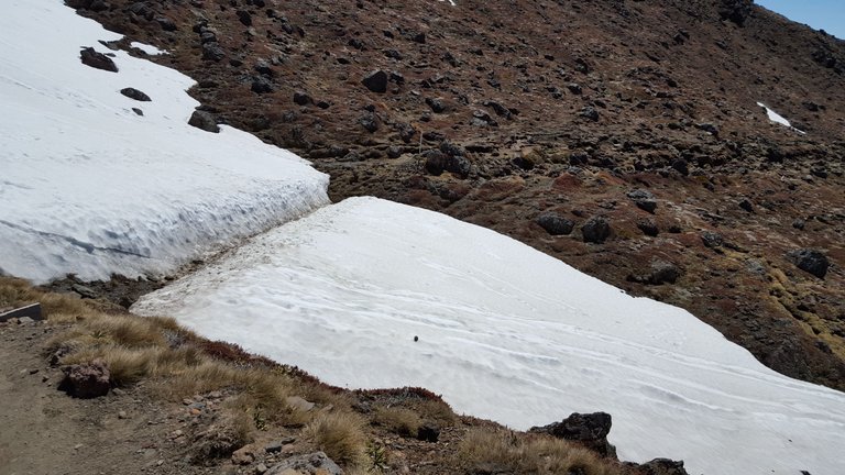
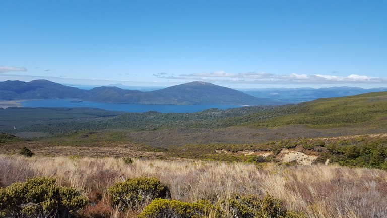
We reached the next scenic spot and that's the South Crater. Interestingly, the snow is there all year round and doesn't melt entirely. I will leave you to enjoy the photos!
Time: 11:00
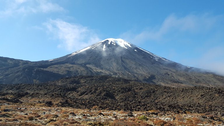
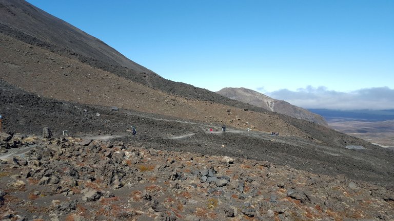
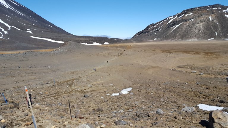
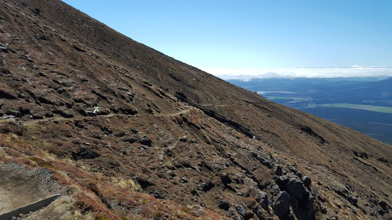
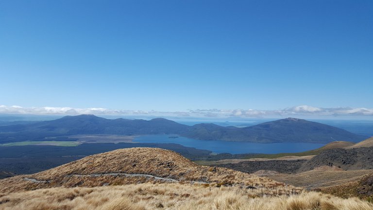
Look how far we hiked! Fortunately, the ground was flat so it was quite easy to walk. But there's more ascending ahead to the peak!
Time: 12:00
We finally reached the peak after a tiring hike. We took our first proper break. Spent some time taking photos, admiring the scenery and ate some snacks to recharge ourselves.
Interesting fact: There were no waste bins around and we needed to pack our rubbish and dispose them after leaving the park.
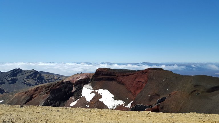
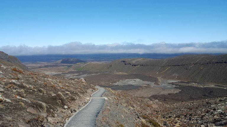
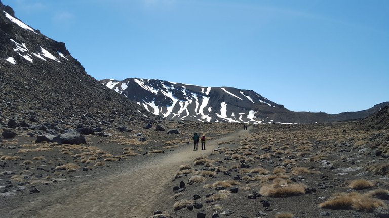
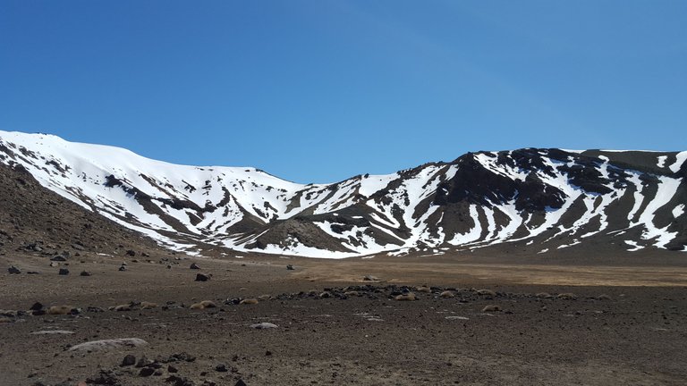
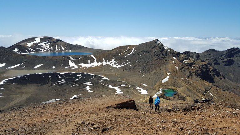
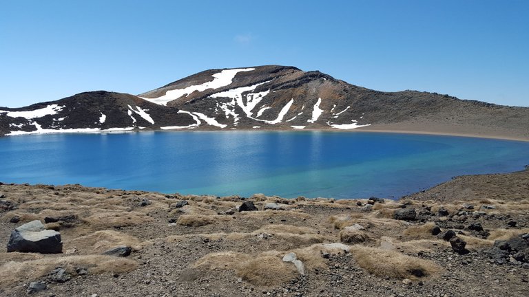
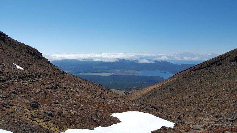
Time to bid South Crater goodbye and we headed towards to the Red Crater and the Emerald Lakes in the distance. As you could see, the path was clearly marked out.
The descend downwards was relatively steep and there were no bars to hold on at the sides. I was extremely glad that I rented hiking boots as normal track shoes might not have such a good grip with all the gravel on the ground. For 30 minutes, we had to be extremely careful, as a slip might mean all the way down (eeks!)
At this point, I must say fatigue has started to set in because of the weight that we were carrying (e.g. water and food, which we had to ration well), the attire we were in, the strong winds (which meant we needed to maintain our balance), and more importantly, the altitude. What kept us on was the scenery, motivating each other along (I think my friend motivated me more than the other way around) and also the fact that there was no way back (lol).
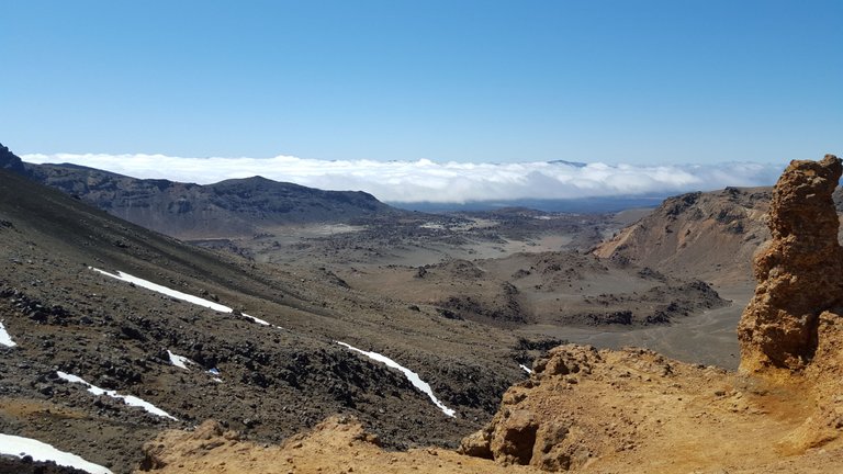
Look how far we descended!
Time: 13:00
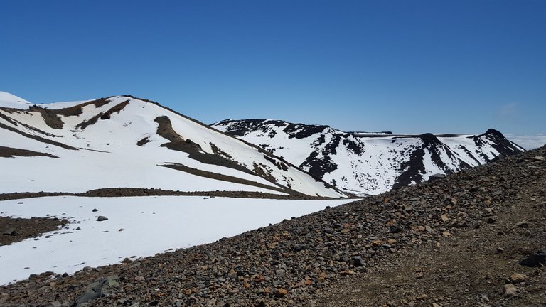
Here we go, next crater and peak! We got distracted by the snow and spent some time fooling around!
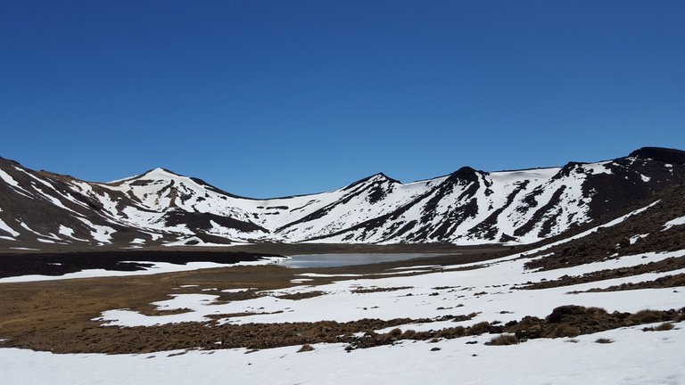
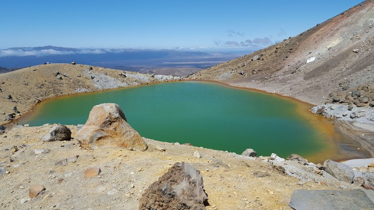
We reached the end of the crater, and what greeted us was the Blue Lake. In my view, this was the most scenic spot of the entire hike. The surroundings looked very peaceful and we decided this was a good spot to take our second proper break. We had our lunch, which was sandwiches prepared by the lodge owners. At this point, we were running behind our schedule but we didn't have much choice as we couldn't possibly skip our lunch.
Time: 14:00
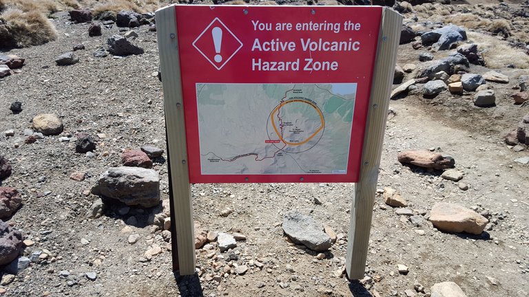
After lunch, we made our way through the most dangerous section of the hike because we were entering an active volcanic hazard zone. It was a small section so the recommendation was to make our way through as fast as we can. Unfortunately, we couldn't sprint through the path as it was full of slopes and some parts were covered in snow (i.e. very slippery). The view was fantastic too!
Time: 15:00
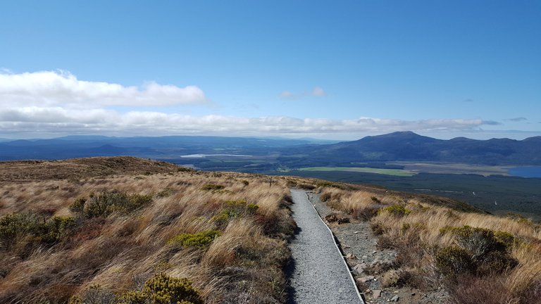
Once we were out of the active volcanic hazard zone, it was back to the comfortable (and safe) wooden plank paths with grasslands on the sides. The terrain was downwards from then on and we tried to make up some time by moving quickly. The scenic views remained but they started to disappear once we moved lower and lower.
Time: 16:00
At this point, my legs were too tired to move and I badly needed a break. So we took a break for the third time. The meeting time with our driver at the end point were supposed to be 1600h but we were still 3km away. I tried to contact the driver but there was no reception in this wilderness.
Time: 17:00
We were concerned that the driver would have left and we might be stuck here for good. So we tried to brisk walk with whatever our remaining energy we had, and didn't have any time to stop and take photos. Finally, we made it to the end point at 1700h and thankfully, our driver actually came back to fetch us (the rest of the group made it to the end by 1600h and he sent them back to the lodge first).
So that's the end of my hike! :)
Thanks for reading and hope you enjoy my sharing and the photos too!
Your content has been voted as a part of Encouragement program. Keep up the good work!
Use Ecency daily to boost your growth on platform!
Support Ecency
Vote for new Proposal
Delegate HP and earn more
Thank you!
!PIZZA for you, fellow metafren
Thank you!
PIZZA Holders sent $PIZZA tips in this post's comments:
@genming(2/5) tipped @relf87 (x1)
vaynard86 tipped relf87 (x1)
Join us in Discord!
Congratulations @relf87! You have completed the following achievement on the Hive blockchain and have been rewarded with new badge(s):
Your next target is to reach 2500 replies.
You can view your badges on your board and compare yourself to others in the Ranking
If you no longer want to receive notifications, reply to this comment with the word
STOPNZ has so much beauty packed into such a small area!
It is a pity about the people.
Great shots!
Thanks for the comment!
Yeah, I only had time during that trip to explore the North Island. I also heard many good things about the South Island so I will have to visit there sometime too.
A great post!
I've been the New Zealand, and some very remote parts of it, and I always find great beauty there, even though it's quite barren on places, maybe it's the solitude that does it? I really love it.
I bet this was a great trek although fearing the driver might not collect you at the end wouldn't have been a nice feeling.
Would you do something like this again?
Thanks for the comment!
Yeah it was definitely a great trek! I must admit I am not an adventurous person to begin with, and it was my friend who suggested to go with this when we were planning the trip back then, and I just went along with it.
Hmm would I do something like this again? Maybe. Definitely not a long hike like this - 19km seems ok on paper but with the altitude and terrain, it was quite tough actually. Perhaps a max of 8 to 10km would be more manageable.
You can hike with me someday if you like, there's a few treks down here in Australia that I think you'll love...Longer than 19km but there's overnight spots to camp on the way and rest. Some time around the campfire with G-dog. What say you?
It's been a while since I did anything close to camping hahaha.. Will let you know if I happen to be in Australia! Which city do reside in most of the time?
I live in Adelaide, South Australia.
!PGM !PIZZA for you!
BUY AND STAKE THE PGM TO SEND A LOT OF TOKENS!
The tokens that the command sends are: 0.1 PGM-0.1 LVL-2.5 BUDS-0.01 MOTA-0.05 DEC-15 SBT-1 STARBITS-[0.00000001 BTC (SWAP.BTC) only if you have 2500 PGM in stake or more ]
5000 PGM IN STAKE = 2x rewards!
Discord
Support the curation account @ pgm-curator with a delegation 10 HP - 50 HP - 100 HP - 500 HP - 1000 HP
Get potential votes from @ pgm-curator by paying in PGM, here is a guide
I'm a bot, if you want a hand ask @ zottone444
Thank you!
damnn I also wanna travel 🥺
Hehe this was way back before Covid!
yeaa fun times
Very nice post and I enjoyed reading it!
Thank you!
It sounds like quite a tedious hike. Beautiful views though.
Yeah it was really tiring. My legs needed one day to recover hehe. But thinking back, it was worth it and I am glad I did it!